Page 2
With few exceptions, most of the streets on the southern end of Barrow Island begin with either the letter "A" or "D" named generally,
after towns in the United Kingdom.
Using his share of the profits from the Devonshire Buildings contract David Caird split with his partner to become a prolific house
builder on Barrow Island in his own right. In 1885, he bought 5,952 square yards of land for development paying a total of £1190.8s. On it
he built the first parts of the "A" streets: Abercorn and Athol. When we look at these streets today they appear as complete blocks, but if
fact they were built piecemeal. The land was bought in plots as supply and demand dictated, and no doubt cash-flow allowed. Only later in
1901 did Caird buy the rest of the land to complete Abercorn paying, on this occasion 5/- [25p] a square yard, [metre], then further plots in
Athol Street in 1901 and 1905 at 3/- [15p] and 5/- a square yard in each respective year.
After Caird started the ball rolling by building part of Ayr Street in 1902, Edmondson and Co made their biggest contribution to Barrow
Island's growth by purchasing land to build Afton and Annan Streets. The asking price had now risen to 6/- a square yard. In the first years
of the 20th century, Caird and Edmondson between them built Anchor Road, which quickly became Old Barrow's shopping centre. Part of
Island Road was snapped up by the Barrow School Board in 1882 for Barrow Island's first school. The Barrow Co-operative Society shortly
afterwards invested £300 for adjacent land and built its first shop on the island, enlarging it in 1905. Funnily, on both occasions fourteen
years apart they paid the high price of 9/- a square yard.
The rest of Barrow Island was built by a number of speculators. Caird was the first in 1887 when he bought a plot for the princely sum
of 3/- a yard. Between 1899 and 1905, W. Tickle, J. Campbell and W. Roberts all bought and built on plots in Island Road.
Continuing the “A” Street theme, Aberdare, Andover were built and lastly Ancaster Street was built in the inter-war years on land that
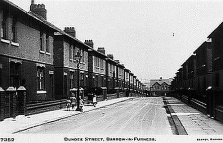
had been Harry Lines’ farm. Later, Banks and Dockeray built The Cavendish Park Estate comprising of Dunoon, Dundee, Dundalk, Dunvegan
and Farm Streets - Vickers, now BAE taking the remainder of the once open parkland for workshops.
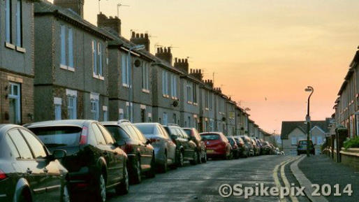
I always thought it strange that while the “A” streets, Aberdeen etc; had a reasonable road width that nowadays, can accommodate
parked cars on either side with room to still drive down the middle. But, with open ground (still) at the rear of both sides of Dundee/Dunoon
Street, why make the road so narrow?
Obviously when these streets were built parking wasn’t a problem - nobody owned a car, but today they must be a delivery driver’s
nightmare.

Dunoon Street (above) and Dundee Street form a triangle with Farm Street to enclose the Recreation Ground with swings and
roundabouts for children, always known as ‘The Rec’

Happy residents of Dundee, Dunoon & Farm St gather at the Rec, possibly for a public stoning.
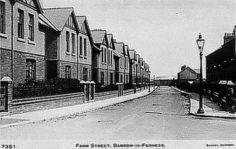
Farm Street named after the farm that was a quarter of a mile to the north of this photo. The farm was one of the few buildings that
existed on Barrow Island before the Duke of Devonshire, James Ramsden et al; had their wicked way with our rural island.
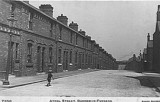

In the old Sankey picture of ATHOL STREET a small boy tries to escape from a falling gas lamp. In the distance the smoking chimney of
Vickers airship shed (later the ADEB, Naval Base), or possibly the Rope Walks, can be seen. What can’t be seen is Ancaster Street and the
line of parked cars that stretches into the distance.
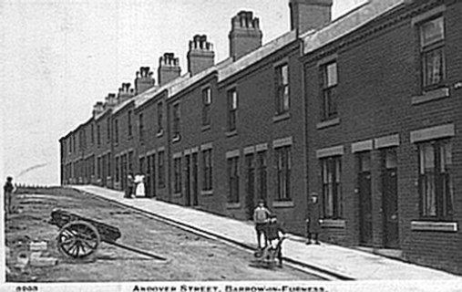
ANDOVER STREET
Nowadays, carelessly parked handcarts are replaced by the ubiquitous Transit van and Ancaster street is still
nowhere to be seen in the Edward Sankey photo.
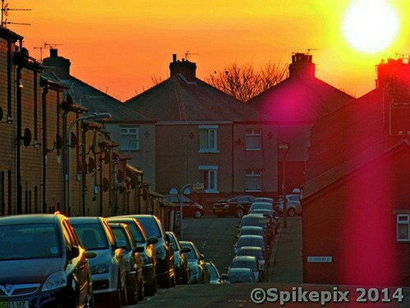
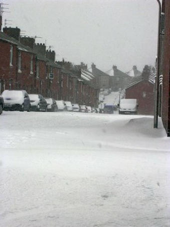

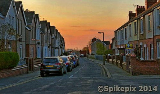
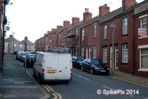
Athol and Andover Street, whatever the weather the line of cars is endless.
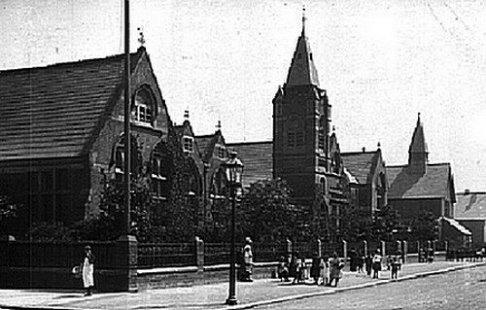
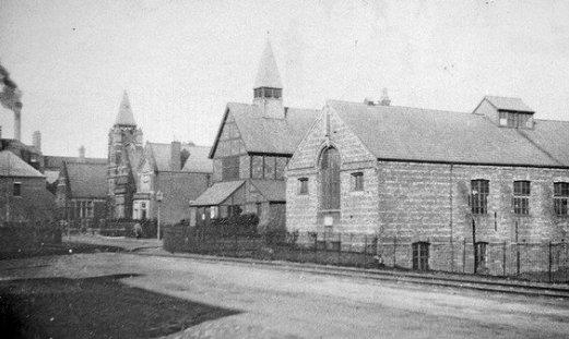
ISLAND ROAD
In the modern view the 1878 St John’s Church has disappeared, to be rebuilt on its present site on the corner of Dunbar Street. The
school tower was demolished in 1958 being in an unsafe condition. The railings were taken for the war effort, the railway lines were lifted
and replaced with grass and trees when Island Road Station, (Shipyard Junction), was closed in 1966.

Children walking to school, on their own!!
Holey moley! What will become of them?
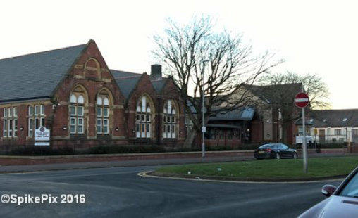
Barrow Island Infants & Primary School was built in 1883 on
land bought by the Barrow School Board in 1882. The school tower
was demolished in 1958.
When it was refurbished in 2013 my Mother, as the oldest
living pupil was invited to attend the reopening, along with the
oldest living Teacher, Mr Fletcher*.
(RIGHT): The youngest Teacher looks on as the youngest pupil
cuts the opening ribbon with a pair of outsized scissors.
*I believe Mr Fletcher has recently passed away, (February
2016). RIP, a fine teacher.
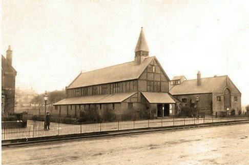


LEFT ABOVE:
A rare picture of George Formby leaning on a lamp post. It also shows the original St
John’s church and the Parish Hall. (Left) is the hall’s foundation stone, a little bit of
history which during recent renovations the builders kindly rendered out of view.
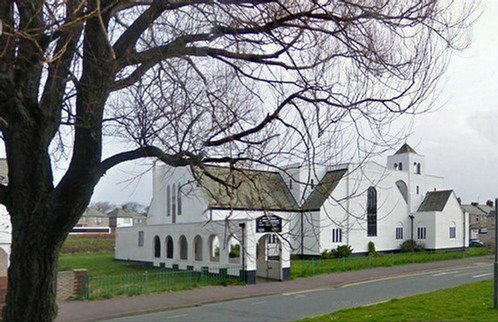
RIGHT ABOVE:
The modern church built in 1932-4 further up Island Road at the corner of Dunbar Street.
St John’s 1925 Outing. Swish charabancs take the congregation on a
May day jolly. In the background the new church has yet to be built.
Much the same view today, the Parish Hall has now been converted
into a number of apartments. Under the outside rendering is the
foundation stone (shown above).

St John the Evangelist church, Island Road under construction in the early 1930s
Page 2