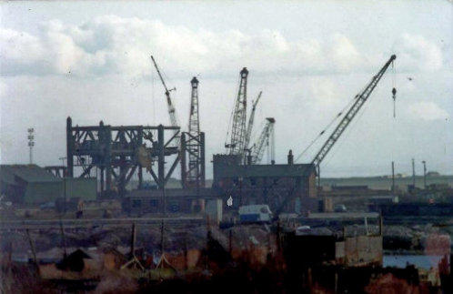
Above & below. Weldit, before & after
This whole area ia now used by Dong for storage and offices for the
offshore wind farms constructed off Walney Island and the Duddon
estuary. This spawned visitors to Barrow docks more usually seen in the
North Sea, huge Supply Boats, Diving Support Vessels and various tugs
and barges. (below).

This slide show is courtesy of Keith McGill, Chief Engineer, (retired). Like me, Keith’s interest in the ships and the sea began
by visiting Ramsden Dock during the 1950s & ‘60s. For him, it became a career path that has served him well. After
travelling the world his abilities led him to work in the hostile, (but rewarding), North Sea.
Now he is happily retired, he’s free to follow his hobby of sampling Real Ales around Cumbria, sometimes at my expense.
(It never seems to be his round)
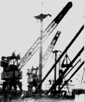
All these cranes are gone now. The photo on the left is of the 10 ton cranes that were on the north side of
Ramsden Dock basin, from a 1949 Barrow Docks Board promotional bochure.
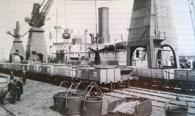
The right hand picture shows electric cranes on the South Side loading Furness Railway wagons in 1917

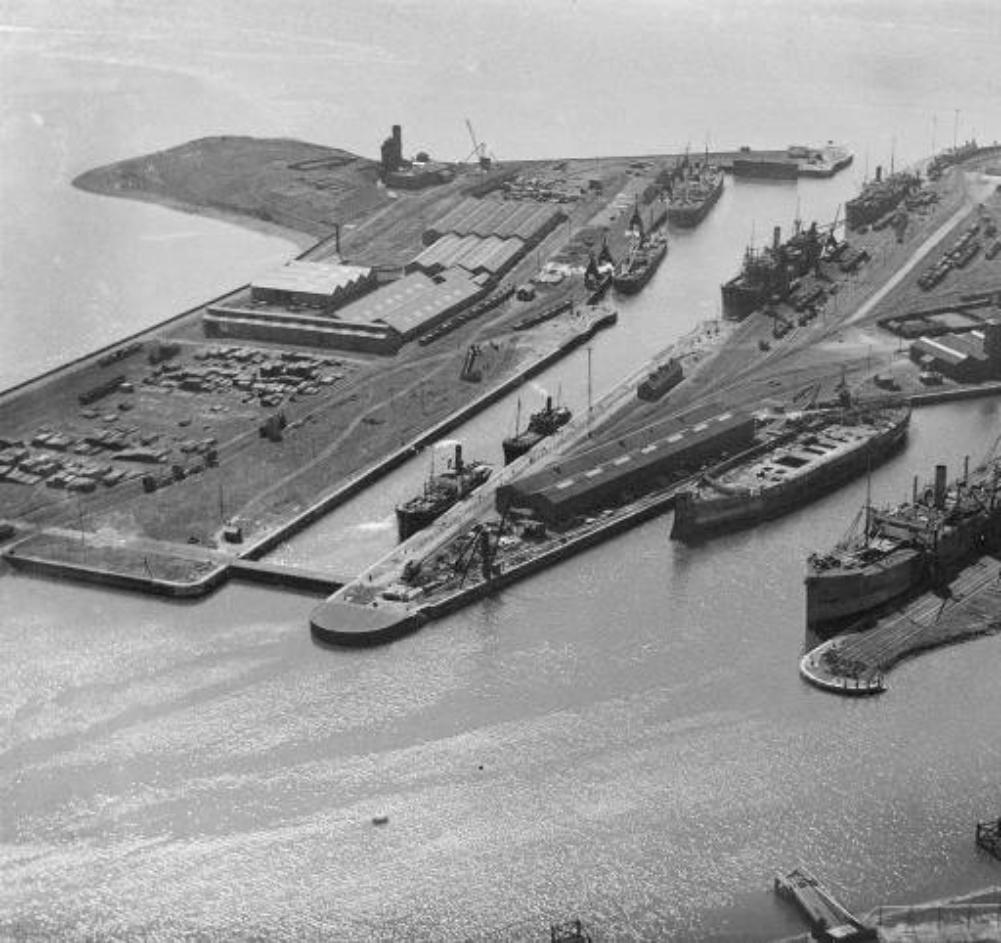
For me, a fascinating view into the past. At top left, (under the logo), can be seen a large sand pit & below that Aureol House. To the right is
the Oil Wells with its large tank farm, a delicious target missed by the Germans.
Moving down the wooden dollies are visible used to berth tankers in deeper water away from the sloping sandstone dock wall. Further round
two tankers can be seen berthed and across the dock Isle of Man Steam Packet boats are lying up for the winter.
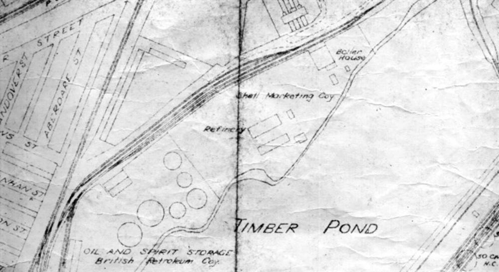
On the left/middle above the ship lying at the Bull’s Nose, is the Timber Pond and the embankment that sealed it off, (except for a pipe that
allowed dock water to enter), from the main dock. The embankment carried a single rail track from the Anchorline to the oil wells, now an
access road to the British Gas Condensate Facility.
The ship with no funnel or superstructure is, I think, being broken up by Thomas Ward, Shipbreakers. When it was demolished almost to the
waterline it would towed round to Ramsey Island and beached, where the job was finished on dry-ish land.
All the warehouses, rail lines & cranes in this picture, have now all disappeared into history.
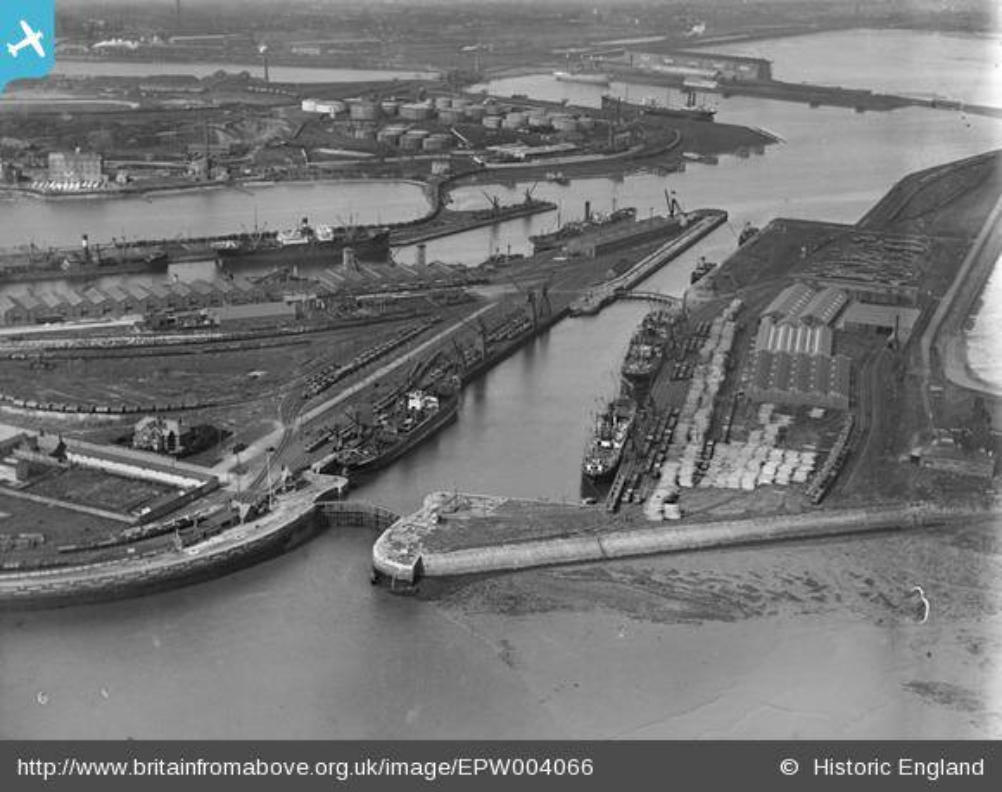
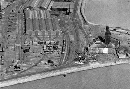
This wonderful aerial photo was taken on the same day in 1920. This time we are looking from above the oil wells towards the dock gates.
Ramsey Island is at the top of the photo with the original dock power station. Below there can be seen cattle sheds & cold store. This area
on the South Side was used in the 1980s by a Scunthorpe firm, Weldit Ltd, to fabricate oil rig jackets which when completed, were towed to
their destination on a large barge towed by American tugs. (see below).
Note the almost plan view of the dollies at the bottom of the pic.
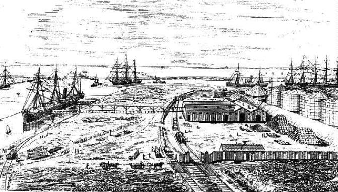
LEFT: An artists’s impression of the Oil Wells
from 1890, this view is looking very roughly,
towards the camera in the picture above
Taken from above Walney Channel showing the entrance to Ramsden Dock, Anchor Line Basin & Timber Pond.
Timber Pond


Oil Wells ‘Dollies’
Ramsey Island Power Station
Area Thos Ward broke up
ships


Weldit Rig Jacket Fabrication Site. (below)
RIGHT: Tugs & Barge
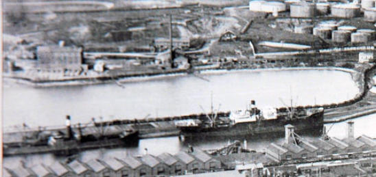
TIMBER POND
REFINERY
ABOVE: Detail of top left area of picture above, see map below.
RIGHT: Detail of Ramsey Island power station.