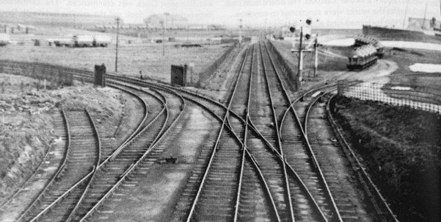
This is a view taken from the wooden bridge
that used to span the cutting between Cavendish
Park & Aureol House. The railway lines in the photo
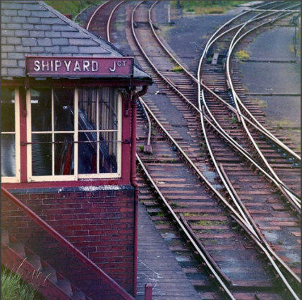
ran from Shipyard (Island Road) station, joining the
dock lines at Shipyard Junction then on to the Cradle
Bridge. The spur off to the left went into the Vickers,
(BAE), Buccleuch Dock wharf, which ran right up to
Michaelson Road. (High Level), bridge.
The spur to the right ran into the Oil Wells,
note the rail tankers.
In this very old photo, the Cradle Bridge
leading to the main Carnforth - Barrow line that lies
straight ahead, can’t be seen. But see below.
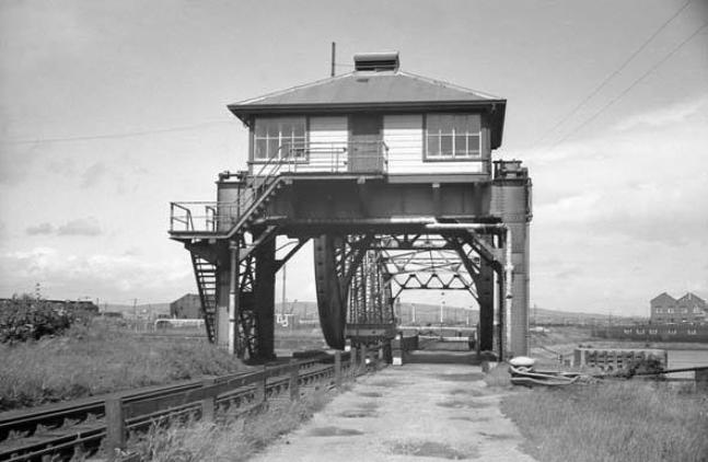
BUCCLEUCH DOCK "Cradle" BRIDGE
Buccleuch Dock Bridge was a vital link connecting the whole of the north side of Ramsden Dock's rail system with the main line at
Salthouse Junction. More commonly known as the 'Cradle Bridge,' because of its shape and lifting action, it traversed the docks system at the
point where Buccleuch and Ramsden Docks meet. It replaced the earlier eighty feet wide swing bridge, built in 1879 - which replaced the
earlier embankment.
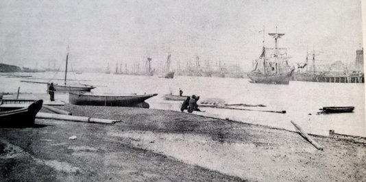
The Barrow Island side of the bridge was built at a place known in Michaelson's day as Cunninger point. This small promontory jutted
out into Barrow Channel to form a bay on its north side known as Welshman's Bay due its popularity with Welsh Skippers seeking sheltered
waters while waiting for a berth to load iron ore at the town wharves.
The Cradle Bridge, more properly called a
Highway and Railway Scherzer Rolling Lift Bridge,
was invented by an American Civil Engineer
called William Scherzer. The Scherzer Rolling Lift
Bridge Company of Chicago, Illinois held the
world patents on the design and a plaque to that
effect was riveted to the finished bridge.
Erected by John Aird and Co, under the
supervision of Furness Railway Engineer Sir
Benjamin Baker, it was made from those old
favourites; cast and wrought iron.
The contract specification drawn up in
1906-4 called for a single leaf bridge 110 feet
long by 26 feet wide capable of fully opening in
one minute, under normal conditions. This no
mean feat was achieved by hydraulic power.
Taking its supply at 650psi from a water main,
each of the two hydraulic engines which were
suspended under the operator's cabin that
straddled the road and railway, produced 60hp at
350rpm. One engine was capable of lifting the
bridge with the other in reserve and if all else
failed, in a dire emergency the bridge could be
lifted by hand. This new Barrow landmark was
officially opened on 12th October 1908.
Political decisions taken in the 1960's ensured the gradual decline of the railways nationally and guaranteed road transport supremacy.
This doctrine continues to be pursed with a maniacal glee by the present government, to the point where in the 21st century all that will
remain will be a few hundred miles of profitable main line.* [see footnote]. If that is found hard to believe, the trend is never more visually
apparent than on the north & south sides of Ramsden Dock. Where once the whole area was overspread with glistening iron spaghetti of
rails: Not one rail now exists.
The closure of, first Millom and then Barrow Iron Works in the 60's
reduced the need for imports of iron ore from Norway through Barrow.
Contrast this with a century earlier where the growth of Barrow could not
be achieved quickly enough to handle the export of iron ore for use
elsewhere. The closure of Millom's iron works especially spelt the demise of
the Cradle Bridge as all the ore traveled over this link to the main line and
then to Millom. The Cradle Bridge was also the link from the main line to
Shipyard Junction in Island Road. From a peak in World War II of five - ten
coach trains a day, bringing workers from the surrounding area to zero
when the trains were re-routed to Barrow Central Station. In 1966 the
Cradle Bridge was declared unsafe and in December of that year it closed
to rail traffic. There followed an ongoing wrangle between the Docks Board
and British Railways over maintenance and repair costs, a matter of some
£30,000. This was the last rivet in the bridge's coffin. So this magnificent
structure went from cradle to grave in 65 years when it was demolished in
1971.
The work to widen the passage between Ramsden and Buccleuch
Docks for the Trident class submarines has now obliterated any last sign of
the Cradle Bridge's existence. Cunninger Point is no longer a point and
Welshman's Bay consequently wouldn't provide shelter to a seagull.
In 1890, Joseph Fisher in his ''Popular History of Barrow,'' noted -
"Mullet were plentiful" in Welshman's Bay. This was true even after the
Cradle Bridge was built. Until 1989 large Mullet could often be seen under
the wooden dolphins on the Buccleuch Dock side of the [now demolished]
bridge. In one surreal episode, me & my mate Marshall fished for Mullet -
using Polo Mints as bait, which he assured me Mullet loved; we almost
caught one!! The latest bout of dredging seems once again to have
frightened them off.
FlatEarth (Internet) Publications. All rights reserved. October 2000.
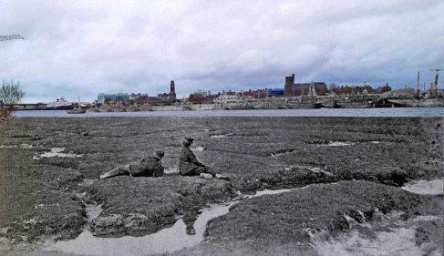
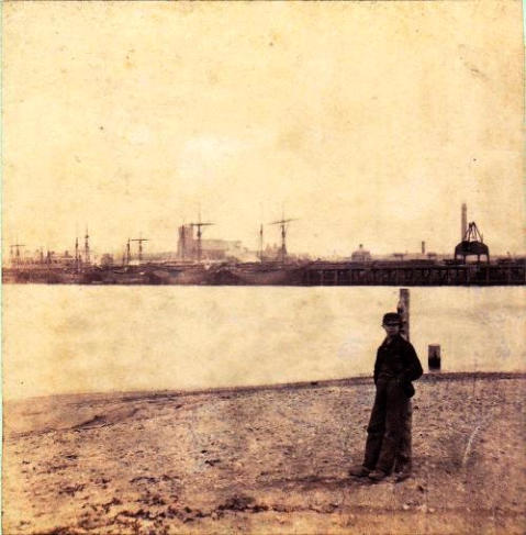
Cunninger Point:
Old & New blended picture. Thanks to Paul Culley - again!
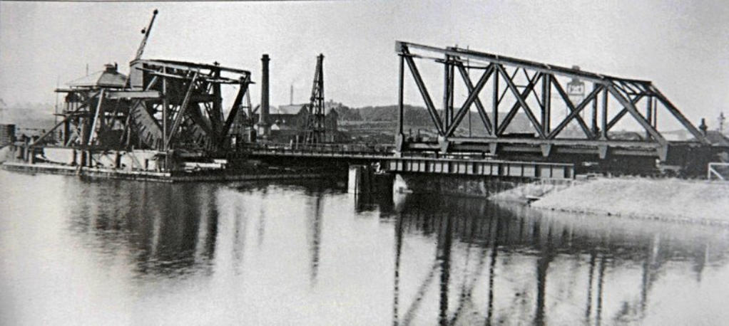
Under construction 1907

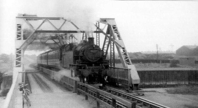
Left: Japanese, Vickers built warship ‘Kongo’ passes through the Cradle Bridge.
Above: Steam train carries shipyard workers home to Grange or Millom. 1954.

A splendid view from the
wooden footbridge above my
Uncle Ted’s signal box.
The 0-6-0 Webb engine with
what looks to be a rather large
tender looks like he’s been doing
a spot of shunting
The cradle bridge can be
seen clearly in this pic, as can the
ADEB buildings.
I’m guessing the picture
dates from the early 1950s
because on the right Roosecote
coal fired Power Station is under
construction. It came on stream
in 1954, so this pic c.1953?

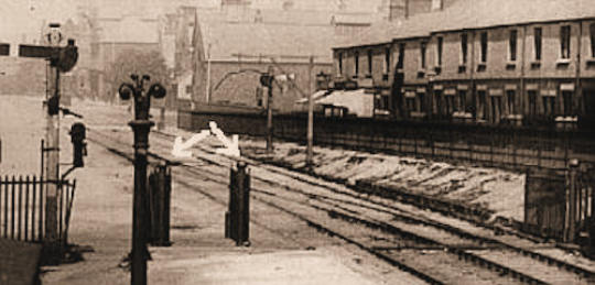
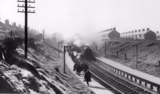
Shipyard Junction leading into Island Road Station.Uncle Ted’s signal
box & the wooden footbridge can be seen in the distance
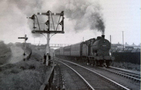
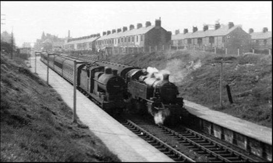
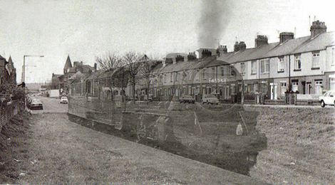
Shipyard worker’s train heads for the Cradle bridge. The hill on
the left led to Aureol House and to the wooden footbridge

SS Magdapur towed by tug Walney?
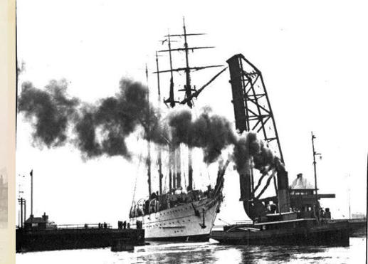
Admirante Saldanha a sail training ship built in 1934 for the
Brazilian Navy passes through the Cradle Bridge
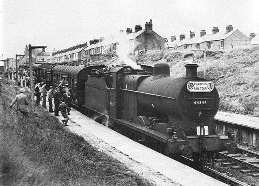
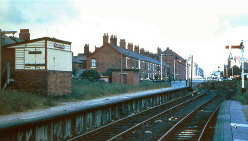
Island Road Station (Shipyard Junction)
Shipyard Junction opened in 1899 was used to enable Vickers (BAE) workers to commute directly between the shipyard and nearby towns served
by the Furness Railway. There were two trains a day, (four - ten coach trains a day during WWI). One went north to Millom & the other south to
Grange. In 1901 it carried more than 1700 workers daily and such was the demand that another platform was added in 1915. Although the
station was never intended for general public use, a limited number of excursion services started in 1915. Popular excursion trips for Rugby
League matches and Sunday School outings were run occasionally.
The closure of Millom's Iron Works in 1963 was the first nail in the Cradle Bridge's demise which was the link from the mainline at Salthouse
Junction to Island Road. This railway link was severed in 1966 when the famous Cradle Bridge across the docks was closed permanently for safety
reasons. (see above). This of course, lead to the station falling into disrepair.
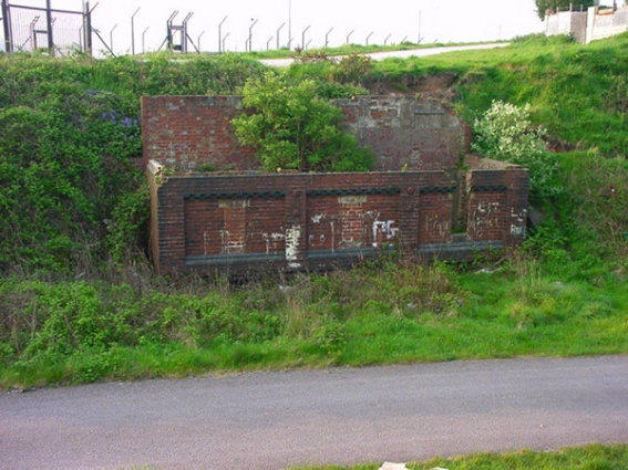
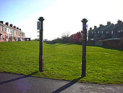
The car parking peoblem on Barrow island wouldn’t be half as
bad if these still ran.

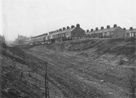
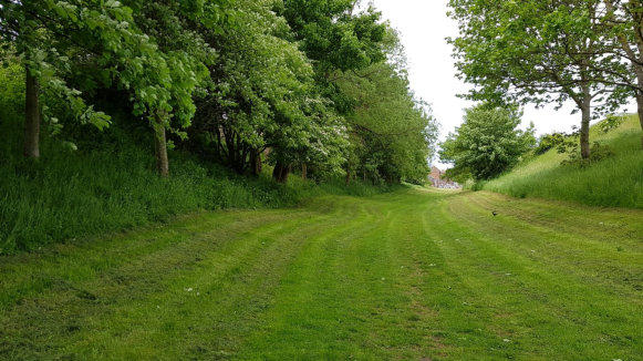
Not so pretty before the trees grew.

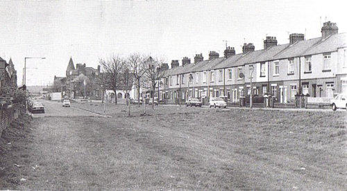
Before and After

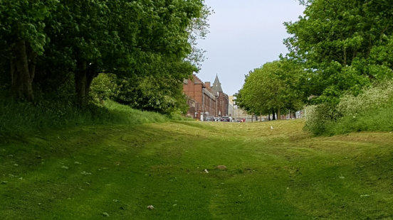
Then and Now
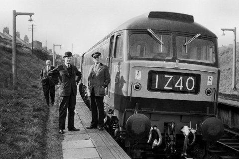
The arrows point to all that is left of the station & right: a ghost train.
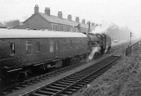
Stanier ‘Black Five’ shunts the carriages

Before & After the Cradle Bridge was closed, desolation.
Above and below: Uncle Ted’s signal box